


Precinct No. 1051, Washoe County, Nevada
About
Outline

Summary
| Unique Area Identifier | 616085 |
| Name | Precinct No. 1051 |
| County | Washoe County |
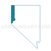
| State | Nevada |
| Area (square miles) | 0.01 |
| Land Area (square miles) | 0.01 |
| Water Area (square miles) | 0.00 |
| % of Land Area | 100.00 |
| % of Water Area | 0.00 |
| Latitude of the Internal Point | 39.50747910 |
| Longtitude of the Internal Point | -119.90147080 |
Maps


Graphs
Select a template below for downloading or customizing gragh for Precinct No. 1051, Washoe County, Nevada


Neighbors
Neighoring Voting District (by Name) Neighboring Voting District on the Map
- Precinct No. 1049, Washoe County, NV
- Precinct No. 1053, Washoe County, NV
- Precinct No. 8503, Washoe County, NV